
The Red Centre, Your Ultimate Guide
If someone were to ask us what has been our ultimate highlight of our trip around Aus so far, we would both very much agree on the Red Centre!
If you’re looking for an adventure getaway with out-of-this-world scenery and true connection to the land, then the Australian Outback will do the job!
This place is just pure magic, unlike anything we’d ever seen before and probably will ever see. We will never forget the changing colours of Uluru and Kata Tjuta during a sunrise or sunset, as they go from red, to bright orange, then blue to deep purple.

When to go
We experienced the Red Centre for over a month, from mid-September to mid-October, and even though you could do it in a couple of days if that is all you have, we always say the more time you have, the better.
Due to this time of year, the weather was absolutely perfect, not too cold at night and more importantly not too hot for our activities during the day.
Helpful Tip
We used the App ‘WikiCamps’ which gave us all the information we needed about where to camp, points of interest, toilets, water etc…and we highly recommend downloading it before you go. Also download ‘Fuel Maps’ as petrol prices are much higher in the Red Centre due to the location and having to cart truck loads in, this app will tell you where it is cheapest. If you are travelling the Red Centre as part of a bigger trip from another state, we would suggest buying a jerry can and filling up before you even get there as it will most likely save you quite a few dollars.
DEVILS MARBLES
As we made our way down from Daly Waters, we visited Karlu Karlu Reserve, or otherwise known as Devils Marbles, roughly 400k North of Alice Springs. We stayed a couple of nights at this reserve, surrounded by huge scattered granite boulders, some of which are precariously balanced atop one another, believed by the Warmungu Aboriginal People to be fossilised eggs of the Rainbow Serpent.

Devils Marbles
ALICE SPRINGS
Next up was Alice Springs, we stayed two nights whilst getting ourselves stocked up and ready for the adventure ahead! During this time we had met some fellow travellers on the road Rachel & Aiden (@rachelgrixti ), and also picked up a friend Emma ( @thehappinesshunter_ ), to join us for two weeks before we picked up the motherboard!

Barrow Creek
EAST MACDONELL RANGES
First up were the East MacDonnell Ranges, only a 20-min drive to the start of the track from Alice. We stayed a couple of nights here and enjoyed exploring the few Gaps along the way and Trephina Gorge Nature Park, before coming back to camp and having camp-fire dinners and movie nights under the stars (and boy are there trillions).
Trephina Gorge

The Drive into East MacDonnell Ranges
WEST MACDONNELL RANGES
Next was the West MacDonnell Ranges, starting at Simpsons Gap only another 20-minutes from Alice.
There are so many beautiful spots along the West Macs, most of them free, one we didn’t visit was Standley Chasm due to the entrance fee and our stingy wallets, even though we’re sure it would be worth it.
Using WikiCamps, we stayed at most of the free camps throughout the West MacDonnell Ranges and we can easily say they are some of the best free camps on our trip so far.
We loved the West MacDonnell Ranges for the many swimming holes and gorges (all croc-free too), as it was so rewarding having a refreshing dip after exploring a new place, and even more so on the warmer days.
Our first swim spot was the famous Ellery Creek Big Hole, a short walk from the carpark and slightly icy temperatures, this spot was a nice for a picnic and a dip.

We kept moving along the ranges loop on Namatjira Drive, checking out Serpentine Gorge Lookout next. This gorge is absolutely incredible, although the 20-minute walk up is steep in some parts, the view at the top is totally worth it.

Time to cool off from Serpentine Gorge, our next location was Ormiston Gorge, another beautiful swimming spot and somewhat busier. It was only a short walk from the carpark to the swimming hole, but there are other walks that take you further but we were happy just swimming the rest of the day away.

Finke River 4WD Camp
Glen Helen was a last-minute decision to check out, and we didn’t go swimming here but for the short walk it’s worth the look. On a calm day you get a beautiful reflection from the gorge cliffs onto the water below.

Mt Sondor
One of the last spots we visited and one of our favourite places on the loop, was Redbank Gorge. The 20-30 min walk in can be a bit deterring, it isn’t marked well and it’s a bit of a scramble over some boulders and rocks to get to the pool, but the best part awaits inside the gorge, not just at the starting pool.
We all jumped in together and despite the sunny day, the water was still surprisingly chilly just like all the other waterholes.
Our friend Emma persuaded us to continue through the high and narrow gorge to see where it ended up…and it was SO worth it!
We swam as far as we could go before needing to get out and climb to the next pool to continue swimming through…and this was where the magic was.
The jagged walls of the gorge surrounded us with a small patch of sky above our heads, and we were the only ones there in this unbelievable moment, experiencing such natural beauty together, a definite highlight and not somewhere you would generally think of when thinking about the Red Centre.

Redbank Gorge

Redbank Gorge
Finishing the loop on our way back to Alice Springs, we thought to check out Tnorala / Gosse Bluff Crater Impact Site. The road in was a little rough for our 2wd van, but once again it was worth it!
It is believed by scientists that it was created by a 600-m wide comet that crashed to earth over 140 million years ago, leaving a 20-km radius crater. The Aboriginal belief is similar in a way that there is an astronomical connection to its creation.

RAINBOW VALLEY
After exploring the West MacDonnell Ranges, we were back in Alice Springs re-stocking before continuing our journey south.
We stopped in at Rainbow Valley Conservation Reserve, a fascinating sandstone formation made up of red and orange stained cliffs that have eroded from the harsh wind and rain, creating the unique jagged-like bluff.
The reserve is located roughly 100km south of Alice Springs, with the last 22km being unsealed road that is quite rough for 2WD, 4WD is recommended.
Fun fact: Right after you exit the reserve and head south on the Stuart Hwy, you will pass through the ‘Centre of Australia’, and it makes an interesting screenshot on your map!

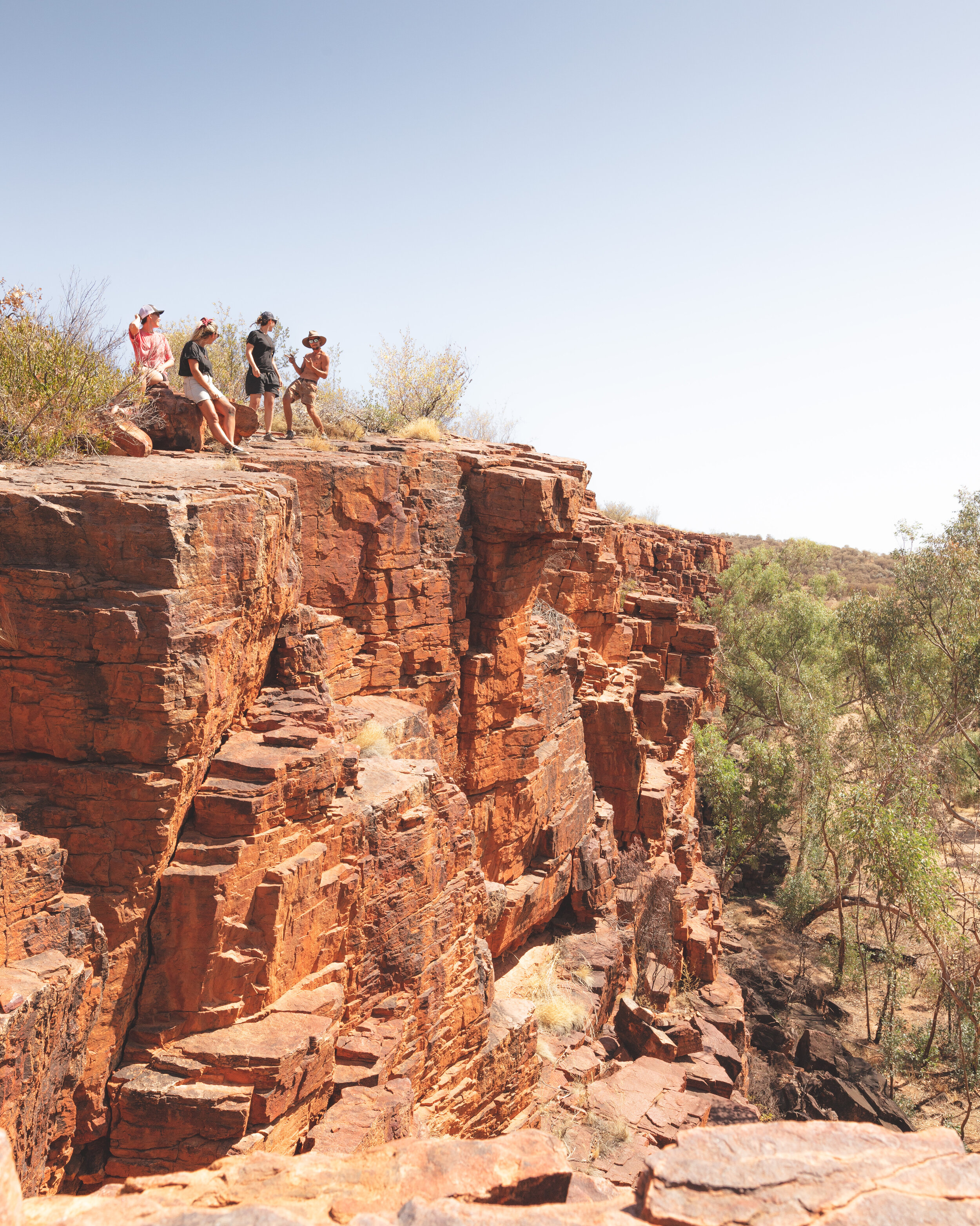
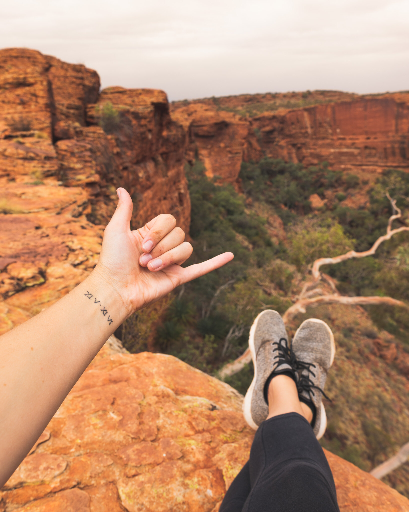
KINGS CANYON – WATARKKA NATIONAL PARK
When you drive south from Alice Springs on the Stuart Hwy, you take a right turn in the direction of Uluru/Kata Tjuta NP along the Lasseter Hwy. Here you will come across a 2.5 hr detour (one-way) out to Kings Canyon in Watarkka National Park, and for us this was another highlight from our visit to the Red Centre and it is not to be missed!
A scenic walk around the canyon rim will take you about 3-4 hours (we done it in 3 hrs incl. photo time), and you are rewarded with unforgettable views into the canyon below, as well as the surrounding landscape. Try and do this early in the morning or before sunset as most of this walk is out in the open and can get very hot in the sun.
On another note, keep your eyes peeled on the drive in here as there are lots of camels in the area.


MT CONNOR
As you get back on the Lasseter Hwy heading towards Uluru/Kata Tjuta NP you will pass by Mt Connor Lookout. Mt Connor is often confused for the first sighting of Uluru, but you will quickly notice the difference in its flat top. Mt Connor is on the private property of Curtain Springs Station and there is no public access, the only way to experience it close-up is to book an exclusive 4WD Tour.

ULURU – KATA TJUTA NATIONAL PARK
We will never forget our drive in, hugging the steering wheel waiting for our first glimpse of ‘the rock’. It was an impressive sight that only became more remarkable the closer you drove towards it, even right up to the base we were filled with ‘wow!’.
The entrance fee into the Uluru/Kata Tjuta National Park is $25 for an adult 3 Day Pass (unlimited entry over 3 days), or you can buy an annual pass for $32.50 (unlimited entry within the year). We chose the annual pass as we were there for more than three days and would be coming back on two separate occasions.
One of the first things we would recommend doing during your time here is to witness a sunset or sunrise over Uluru and Kata Tjuta (The Olgas aka Uluru’s bigger brother). To observe these phenomenon’s change colour from a red-y orange, to purple-pink and striking blue behind a full star-filled sky is pure magic!
You can choose to bike, Segway, or walk the base of Uluru, or if you’re up for it you can Skydive the rock! There are a few walks you can do through Kata Tjuta and we would highly recommend the ‘Valley of the Winds’ walk – one of the best walks we have done so far on the trip, just make sure you go early in the morning for hotter days as the walks do close if it is due to get above a certain temperature.
Take note that it’s an approx. 45-minute drive between Uluru and Kata Tjuta.
Driving through this sunburnt land you feel so connected to what is the World’s Oldest Living Culture of the Aboriginals, and there are many stories to learn about their culture by taking a visit to the Cultural Centre in Yulara, the town based at Uluru.


GETTING HERE
With two airports servicing the area, you can do a one-way trip to experience everything including the MacDonnell Ranges, and fly in and out of opposite airports. From Alice Springs Airport and Ayers Rock Airport (Connellan Airport) in Yulara, the gateway to Uluru/Kata Tjuta National Park, you can book a tour or hire a car and experience it on your own. Take note these airports are located approx. 5hrs 15mins away from each other.


ACCOMMODATION
There are a few accommodation options depending on your budget, from Luxury 5 Star Resorts to our preferred option – camping!
There are a couple of free camps outside of the National Park and if you do your research to find this one…you will have a billion-star view – literally!

Well here you have it folks, a run-down of our time in our favourite place in Australia – so far!
We hope this helps you plan your own little adventure to this epic place, and if you have any questions or comments please leave them below in the comments section or send us a direct message on Instagram.
Until next time,
Sarah and Amy